Chakulia
Chakulia is a nagar panchayat in the Ghatshila subdivision of the Purbi Singhbhum district in the state of Jharkhand, India.
Chakulia | |
|---|---|
Nagar Panchayat | |
| Nickname(s): CKU | |
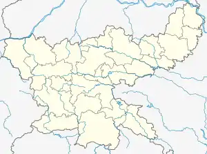  Chakulia Location in Jharkhand, India  Chakulia Chakulia (India) | |
| Coordinates: 22.48°N 86.72°E | |
| Country |  India India |
| State | Jharkhand |
| District | Purbi Singhbhum |
| Government | |
| • Type | Nagar Panchayat |
| • Body | Chakulia Nagar Panchayat |
| Area | |
| • Total | 20.1 km2 (7.8 sq mi) |
| Elevation | 115 m (377 ft) |
| Population (2011) | |
| • Total | 125,116 |
| • Density | 6,200/km2 (16,000/sq mi) |
| Languages | |
| • Official | Bangla, Hindi, Santhali |
| Time zone | UTC+5:30 (IST) |
| Telephone code | 06594 |
| Vehicle registration | JH |
| Website | udhd |
History
An airfield was built here by the British in 1942 to conduct raids against the advancing Japanese in Burma and also for operations to transport aid to parts of China. Also, in 1971, during the war of independence of Bangladesh, a guerrilla training camp was set up and used for training volunteers.
Geography
Chakulia is located at 22.48°N 86.72°E.[1] It has an average elevation of 115 metres (377 feet). Lying on the foothills of Dalma Hills, this place is known for its natural environment, and the green lush field of farmers.
Civic administration
There is a police station at Chakulia.[2]The headquarters of Chakulia CD block is located at Chakulia town.[3]
Demographics
As of 2001 India census,[4] Chakulia had a population of 14,330. Males constitute 52% of the population and females 48%. Chakulia has an average literacy rate of 64%, higher than the national average of 59.5%; with male literacy of 73% and female literacy of 54%. 13% of the population is under 6 years of age.
Economy
Chakulia is famous for its detergent soap and powder manufactured by South East Chemical/Hindustan Soap Factory and also known for bamboo.
Transportation
Chakulia is connected by railway and road, and lies in the Howrah-Mumbai rail route. It is also among the major economic hubs which lie between Jamshedpur and Kharagpur. Trains and transport vehicles are easily available from major nearby cities, such as Kharagpur (West Bengal), Tatanagar (Jharkhand), Baripada (Orissa). Chakulia also has an Airfield which was used heavily during the World War II: Chakulia Airport.
References
- Falling Rain Genomics, Inc - Chakulia
- "District Police Profile – East Singhbhum". Jharkhand Police. Retrieved 8 December 2021.
- "District Census Handbook, Purbi Singhbhum, Series 21, Part XII A" (PDF). Page 112: Map of Chakulia CD block. Directorate of Census Operations Jharkhand. Retrieved 8 December 2021.
- "Census of India 2001: Data from the 2001 Census, including cities, villages and towns (Provisional)". Census Commission of India. Archived from the original on 16 June 2004. Retrieved 1 November 2008.