Sharur-Daralagez Uyezd
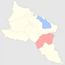
The Sharur-Daralagez Uyezd (Russian: Шарур-Даралагезский уезд; Armenian: Շարուր-Դարալագյազի գավառ; Azerbaijani: Şərur-Dərələyəz qəzası) was an uyezd of the Erivan Governorate of the Caucasus Viceroyalty of the Russian Empire. It bordered the governorate's Erivan and Novobayazet Uyezds to the north, the Nakhichevan Uyezd to the south, the Zangezur and Jevanshir Uyezds of the Elisabethpol Governorate to the east, and Persia to the southwest. It included most of the Vayots Dzor Province of present-day Armenia and the Sharur District of the Nakhichevan exclave of present-day Azerbaijan. Its administrative center was the village of Bash-Norashen (Şərur).[1]
Sharur-Daralagez Uyezd
Шарур-Даралагезский уезд | |
|---|---|
.png.webp) Coat of arms | |
 | |
| Country | Russia |
| Political status | Uyezd |
| Region | Caucasus |
| Established | 1870 |
| Abolished | 1917 |
| Area | |
| • Total | 2,971 km2 (1,147 sq mi) |
| Population (1916) | |
| • Total | 90,250 |
| • Density | 30/km2 (79/sq mi) |
Geography
The geography of the uyezd resembled a crater surrounded from the south, north and east by tall mountain ranges of the Lesser Caucasus. The plain, which made up a small part of the uyezd, was close to the Aras River, into which the only river irrigating the plains, the Arpa-chay, discharged. The mountainous part of the territory was called Daralagez and the lowland part was called Sharur. Daralagez constituted approximately 70% of the whole uyezd area and Sharur constituted approximately 30%, even though it included about half of the uyezd's population. The Arpa-chay started at the southeastern tip of Lake Sevan (Gokcha) and flowed 107 versts before discharging into the Aras. It had many tributaries, the Alagyoz-chay being the longest. Approximately 12,150 desyatins of the mountainous part of uyezd was forested. The temperature in the winter reached -27 °C.[2]
History
The territory of the uyezd was part of Persia's Erivan and Nakhichevan Khanates until 1828, when according to the Treaty of Turkmenchay, they were annexed to the Russian Empire. It was administered as part of the Armenian Oblast from 1828 to 1840.[3] In 1844, the Caucasus Viceroyalty was re-established, in which the territory of the Sharur-Daralagez Uyezd formed part of the Tiflis Governorate. In 1849, the Erivan Governorate was established, separate from the Tiflis Governorate. It was made up of the Erivan, Nakhchivan, Aleksandropol, Novobayazet, and Ordubad Uyezds. Following administrative reforms, the northern part of the Nakhchivan Uyezd (Daralagez) was separated to form part of the new Sharur-Daralagez Uyezd in 1870.[4] In 1918-1920, the uyezd was disputed between the First Republic of Armenia and the Azerbaijan Democratic Republic.[5] After the establishment of Soviet rule in 1920, the territory of the uyezd was divided. Daralagez became part of the Armenian SSR and Sharur became part of the Nakhichevan ASSR of the Azerbaijan SSR in accordance with the treaties of Moscow and Kars.[5][6]
Administrative Divisions
The Sharur-Daralagez Uyezd was split into 2 unnamed contiguous uchastki (subcounties):
Demographics
According to the 1897 Russian Empire Census, the population of the uyezd was 76,538, of which 51,560 were Tatars (modern Azerbaijanis; 67.4%), 20,726 were Armenians (27.1%), and 3,761 Kurds (4.9%).[7] The largest town in the district was Keshishkend (Yeghegnadzor) in Daralagez, which had a total population of 1,307. The administrative center of the district, the village of Bash-Norashen in Sharur, had a total population of 867, of which 597 (68.8%) were Tatars, 132 (15.2%) Armenians, 90 (10.3%) Kurds, and 31 (3.5%) East Slavs (Russians, Ukrainians, and Belarusians).[8] Armenians were mostly concentrated in mountainous Daralagez, while lowland Sharur was overwhelmingly Tatar. The population in Daralagez was engaged primarily in cattlebreeding while the residents of Sharur were engaged in agricultural farming and gardening. Manufacturing was not developed in this part of the governorate. Only 47 winemaking enterprises, 299 mills, 89 cotton-cleaning, 4 rice-cleaning factories existed in the Sharur-Daralagez Uyezd.[2]
Caucasian Calendar of 1917
The 1917 Caucasian Calendar which produced statistics of 1916 indicates 90,250 residents in the Sharur-Daralagez Uyezd, including 47,399 men and 42,851 women, 88,496 of whom were the permanent population, and 1,754 were temporary residents. The statistics indicated the uyezd to be overwhelmingly Azerbaijani, with a sizeable Armenian minority which was mainly concentrated in the eastern Daralagez subdistrict:[9]
| Area | Russians | Other
Europeans |
Armenians | North Caucasians | Kurds | Other Asian Nationalities | TOTAL | ||
|---|---|---|---|---|---|---|---|---|---|
| Christian | Shia Muslim | Sunni Muslim | |||||||
| Sharur-Daralagez Uyezd | 122 | 8 | 29,165 | 3 | 1,861 | 598 | 57,982 | 511 | 90,250 |
| 0.1% | 0.0% | 32.3% | 0.0% | 2.1% | 0.6% | 64.2% | 0.6% | 100.0% | |
References
- Tsutsiev, Arthur (2014). Atlas of the Ethno-Political History of the Caucasus. Translated by Nora Seligman Favorov. New Haven: Yale University Press. p. 59. ISBN 9780300153088.
- Большой энциклопедический словарь Брокгауза и Ефрона. Шаруро-Даралагезский уезд [Brockhaus and Efron Encyclopedia Dictionary. Sharur-Daralagyoz Uyezd] (in Russian).
- Bournoutian, George A. (1992). The Khanate of Erevan Under Qajar Rule, 1795-1828. Costa Mesa: Mazda Publishers. p. 26. ISBN 9780939214181.
- "Административно-территориальные реформы на Кавказе в середине и во второй половине XIX века" [Administrative-territorial reforms in the Caucasus in the middle and second half of the 19th century] (in Russian).
- Tsutsiev, pp. 71–76.
- Договор о дружбе между Армянской ССР, Азербайджанской ССР и Грузинской ССР, с одной стороны, и Турцией - с другой, Заключенный при участии РСФСР в Карсе [Treaty of friendship between the Armenian SSR, Azerbaijan SSR, and Georgian SSR on one side and Turkey on the other, with the participation of the Russian SFSR in Kars] (in Russian). Archived from the original on 2007-04-24.
- (in Russian) 1897 Census, Sharur-Daralagezsky Uyezd Demoscope Weekly
- (in Russian) 1897 Census, Bash-Norashen Village Demoscope Weekly
- Кавказский календарь .... на 1917 год (in Russian). pp. 367–370.
Administrative divisions of the Erivan Governorate | ||
|---|---|---|
| ||
Italics indicates abolished uyezds. | ||