Erivan Governorate
The Erivan Governorate (Old Russian: Эриванская губернія; Armenian: Երևանի նահանգ) was one of the guberniyas of the Caucasus Viceroyalty of the Russian Empire, with its centеr in Erivan (present-day Yerevan). Its area was 27,830 sq. kilometеrs.[1] It roughly corresponded to what is now most of central Armenia, the Iğdır Province of Turkey, and the Nakhichevan exclave of Azerbaijan. At the end of the 19th century, it bordered the Tiflis Governorate to the north, the Elisabethpol Governorate to the east, the Kars Oblast to the west, and Persia and the Ottoman Empire to the south. The Mount Ararat and the entire Ararat Valley were in the center of the state.
Erivan Governorate
Эриванская губерния | |
|---|---|
.png.webp) Coat of arms | |
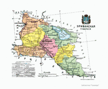 Administrative map (1913) | |
| Country | Russia |
| Political status | Governorate |
| Region | Caucasus |
| Established | 1849 |
| Abolished | 1917 |
| Area | |
| • Total | 31,672 km2 (12,229 sq mi) |
| Population (1916) | |
| • Total | 1,120,242 |
| • Density | 35/km2 (92/sq mi) |
In 1828, the khanates of Erivan and the Nakhichevan were annexed from Persia by the Russian Empire in accordance with the Treaty of Turkmenchay. They were included into a single administrative unit named the Armenian Oblast. In 1849 the oblast was reorganized into a governorate,[2] and by 1872, it consisted of seven uyezds.
| History of Armenia |
|---|
 Coat of Arms of Armenia |
| Timeline • Origins • Etymology |
History
By Emperor Nicholas I, on April 10, 1840, Transcaucasia was divided into two administrative units: Georgia-Imeretia Governorate( center: Tiflis) and Caspian Oblast (center: Shamakh). The religious and national affiliations of the peoples of Transcaucasia were not taken into account during the division, which led to the dissatisfaction of the indigenous peoples. In 1846 these two units were dissolved. Instead of the Georgian-Imereti governorate, the Tiflis Governorate and Kutais Governorate were formed. In 1849, by a special imperial decree, the Erivan Governorate was separated from the Tiflis Governorate.[2] The region of Meghri was temporarily annexed into the Erivan Governorate.[2]
In 1872, the Erivan Governorate was consisted of 7 administrative districts: Alexandropol, Erivan, Novobayazet, Sharur-Daralagyaz, Echmiadzin, Nakhichevan and Surmalu.[3] Besides Erivan, other important cities were Alexandropol, Nakhichevan, Novobayazet and Echmiadzin.
In 1918, the First Republic of Armenia was formed in the territory of Erivan Governorate including parts of Kars Oblast, Elisabethpol and Tiflis Governorates, with Yerevan as its capital.
Development
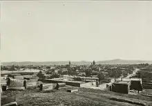
From 1880-90, the cities of the governorate started to grow, connecting with other provincial centers: Tiflis, Kutais, Elisabethpol and Baku. The Transcaucasus railway has been built since the end of the 19th century. The railway from Tiflis reached Alexandropol in 1897, which became a railway center (Gyumri railway station). The Alexandropol-Kars (Kars-Gyumri-Tbilisi) railway was put into operation in 1899, and the railway from Alexandropol (Gyumri) station to Erivan in 1901. In 1906, the Erivan-Jolfa railway was put into operation[4] so Erivan established connection with Iran. Highways of state significance were improved. The trade between the cities became more active, the crafts developed again, the industry began. The first hydropower plant was put into operation.[5] Long distance telephone և telegraph connection was established.[4] Later, the Transcaucasus Railway was connected to the Russian railway network, with Erivan connecting with Moscow, St. Petersburg, and the seaport of Batum with the Mediterranean countries.
Development of Erivan[4][6]
(see also: History of Yerevan)
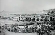
The Armenian secular elite, together with the Russian authorities, started a new phase of development of Erivan(Yerevan). In 1832, the provincial school of Yerevan was opened. In the same year a library was established, which was later enriched and became the largest and famous library in Armenia (National Library of Armenia). Five years later, in 1837, a diocesan school was opened. In 1850 the girls' college was founded. In 1856 the first plan of the city was approved. In 1860 a parish school was opened in Nork. In 1863, Astafyan (now Abovyan) Street was opened, and by the end of the century, there were also other parallel vertical streets, which created a more or less regular network of transport routes in the center. In 1866, the Gaianean Girls' College was opened.
In 1879, by Royal order, a new position of mayor was established in Yerevan. Hovhannes Ghorghanyan was appointed the first mayor. Through the efforts of Ghorghanyan and the city elite, under the auspices of the Russian Empire, in 1881 the Erivan Teachers' Seminary was opened (now a Yerevan State University building). In the same year, the Yerevan Beer Factory was opened, in 1887, Tairyan Vodka, Alcohol and Wine Factory, in 1892, Mineral Water and Syrup Factory, in 1893, Afrikyan and Gyulazyan Factory, and in 1894, Sarayev Wine and Brandy factory. In 1890, Tairyan's factory was bought by the Russian manufacturer Shustov, with large investments, the production of brandy increased tenfold (see Shustov vodka). In 1907, the city was partially electrified, in 1913, it was telephoned.[4] In 1912, drinking water was brought from Forty Springs.[6] There was an electric tram and a horse-drawn carriage in the city. New shops and hotels were opened. In 1913, the first car entered the city. In 1913, there were 4 clinics, 3 pharmacies, an ophthalmology clinic and a psychiatric hospital.
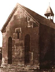
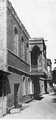
At the end of the 19th century, Yerevan continued to be an eastern town with its narrow, crooked streets, houses built of clay and small stones, markets and baths, churches and mosques. The width of the streets did not exceed 3-4 meters. Streams flowed on both sides. The city had a number of well-known urban areas: the city center - Shahar, the market - Ghantar (Persian: Libra), Kond or Tsirani Tagh, Dzoragyugh, Nork, Shen Tagh, Boulevard, Berd, etc.[6] Due to economic development, the city's population tripled in 30 years, reaching 35,000 in 1913.[4] Along with the Armenian districts, there were districts inhabited by other nations, mainly Tatars (later known as Azerbaijanis). The national minorities had their own schools, secular and spiritual centers. Several new Armenian churches were built, one of which was St. Gregory the Illuminator Church (now demolished). At the end of the 19th century and at the beginning of the 20th century Russian churches were built, St. Nicholai Cathedral and Church of the Intercession of the Holy Mother of God.
Administrative division
Until 1872, the various districts of the Erivan Governorate were still referred to by their Persian designation mahal ("small district").[7] After 1872, the Russians split the Erivan Governorate into seven uyezds ("large districts").[7] The seven uyezds were: Erivan, Echmiadzin, Surmalu, Nakhichevan, Alexandropol, Sharur-Daralagez and Novobayazet.[7] Novobayazet was the largest uyezd of the governorate, whereas Sharur-Daralagez was the smallest.[7]
From the 1897 Russian Empire Census:
| № | Uyezd | Administrative center | Area | Population | ||||
|---|---|---|---|---|---|---|---|---|
| 1897 | 1916 | km2 | versts2 | 1897 | 1916 | |||
| 1 | Alexandropol | Alexandropol | 30,616[8] | 51,874 | 3,854.28 | 3,386.70 | 168,435 | 226,080 |
| 2 | Nakhichevan | Nakhichevan | 8,790[9] | 8,934 | 4,482.87 | 3,939.04 | 86,878 | 136,859 |
| 3 | Novobayazet | Novobayazet | 8,486[10] | 14,748 | 4,691.96 | 4,122.76 | 112,111 | 188,859 |
| 4 | Surmalu | Igdir | 4,860[11] | ... | 3,581.58 | 3,147.09 | 88,844 | 104,791 |
| 5 | Sharur-Daralagez | Bash-Norashen | 867[12] | ... | 3,001.64 | 2,637.50 | 76,551 | 90,250 |
| 6 | Erivan | Erivan | 29,006[13] | 51,286 | 3,100.42 | 2,724.30 | 127,072 | 205,617 |
| 7 | Echmiadzin | Echmiadzin | 5,267[14] | ... | 3,858.0 | 3,237.40 | 124,643 | 167,786 |
Demographics[15]
Russian Imperial Census of 1897
According to the Russian census of 1897, the Erivan Governorate had 829,556 inhabitants 92323 living in the cities.[16] The largest cities were Alexandropol (30616[8]) and Erivan (29006[13]). 53.2% of the governorate's population were Armenians, 37.8% were Tatars (later known as Azerbaijanis).[17] The Tatars were in a majority in the Erivan, Nakhichevan, Sharur-Daralagez, and Surmalu uyezds; the other three uyezds (Alexandropol, Novobayazet, Echmiadzin) were predominantly Armenian. Wherein, in the city of Erivan and in Igdyr (center of Surmalu uyezd) the Armenian population was exceeding the Tatarian.[13][11]
Other ethnic minorities were including Kurds (8.4%), Russians (2.1%), as well as smaller numbers of Assyrians, Greeks, Georgians, Jews, Poles, and Gypsies.[16]
As a result of the constant immigration of Armenians to the Russian Armenia after the Hamidian massacres in the Ottoman Empire in 1894-96, the percentage of the Armenians in Erivan Governorate gradually increased. According to the Central Statistical Committee of the Russian Empire, in 1905 there were 901,900 residents in Erivan Governorate.
The demographic picture changed dramatically in favor of the Armenians, especially after the World War I and the Armenian genocide.
Ethnic groups by Uyezd[18]
Ethnic groups in Erivan Governorate according to 1897 Russian census.[19]
| Uyezd | Armenians | Tatars (i.e. Azerbaijanis) | Kurds | Russians | Assyrians |
|---|---|---|---|---|---|
| TOTAL | 53.2% | 37.8% | 6.0% | 1.6% | 0.3% |
| Alexandropol | 85.5% | 4.7% | 3.0% | 3.4% | ... |
| Nakhichevan | 34.4% | 63.7% | ... | ... | ... |
| Novobayazet | 66.3% | 28.3% | 2.4% | 2.2% | ... |
| Surmalu | 30.4% | 46.5% | 21.4% | ... | ... |
| Sharur-Daralagez | 27.1% | 67.4% | 4.9% | ... | ... |
| Erivan | 38.5% | 51.4% | 5.4% | 2.0% | 1.5% |
| Echmiadzin | 62.4% | 29.0% | 7.8% | ... | ... |
Ethnic groups by City
Ethnic groups in the centers of Uyezds according to 1897 Russian census.[19]
| City / Town | Armenians | Tatars (i.e. Azerbaijanis) | Kurds | Russians | Assyrians |
|---|---|---|---|---|---|
| Alexandropol (Gyumri) | 71.1% | 3.6% | 0.03% | 16.8% | ... |
| Nakhichevan | 25.7% | 69.6% | 0.02% | 2.6% | 0.04% |
| Novobayazet (Gavar) | 95.4% | 0.5% | 2.8% | 0.7% | ... |
| Igdir | 84.1% | 1.8% | 1.5% | 11.9% | ... |
| Erivan (Yerevan) | 43.2% | 42.6% | 0.2% | 10.9% | 0.3% |
| Echmiadzin (Vagharshapat) | 94.9% | 1.3% | 0.4% | 2.7% | 1% |
Caucasian Calendar of 1917
The 1917 Caucasian Calendar which produced statistics of 1916 indicates 1,120,242 residents in the Erivan Governorate, including 589,125 men and 531,117 women, 1,014,868 of whom were the permanent population, and 105,374 were temporary residents.[20]
| Uyezd (district) | Russians | Other
Europeans |
Georgians | Armenians | North Caucasians | Kurds | Other Asian Nationalities | Gypsies | Jews | TOTAL | ||||
|---|---|---|---|---|---|---|---|---|---|---|---|---|---|---|
| Orthodox | Sectarian | Muslim | Yezidi | Christian[lower-alpha 1] | Shia Muslim[lower-alpha 2] | Sunni Muslim[lower-alpha 3] | ||||||||
| Alexandropol | 5,588 | 1,800 | 342 | 0 | 202,505 | 0 | 71 | 5,901 | 493 | 7,197 | 1,983 | 46 | 154 | 226,080 |
| 2.5% | 0.8% | 0.2% | 0.0% | 89.6% | 0.0% | 0.0% | 2.6% | 0.2% | 3.2% | 0.9% | 0.0% | 0.1% | 100.0% | |
| Nakhichevan | 576 | 128 | 57 | 168 | 54,209 | 6 | 517 | 0 | 7 | 81,191 | 0 | 0 | 0 | 136,859 |
| 0.4% | 0.1% | 0.0% | 0.1% | 39.6% | 0.0% | 0.4% | 0.0% | 0.0% | 59.3% | 0.0% | 0.0% | 0.0% | 100.0% | |
| Novobayazet | 160 | 4,765 | 398 | 0 | 129,347 | 0 | 2,964 | 408 | 102 | 46,901 | 3,812 | 0 | 2 | 188,859 |
| 0.1% | 2.5% | 0.2% | 0.0% | 68.5% | 0.0% | 1.6% | 0.2% | 0.1% | 24.8% | 2.0% | 0.0% | 0.0% | 100.0% | |
| Surmalu | 420 | 9 | 60 | 0 | 32,686 | 0 | 14,679 | 10,869 | 19 | 44,153 | 1,801 | 0 | 95 | 104,791 |
| 0.4% | 0.0% | 0.1% | 0.0% | 31.2% | 0.0% | 14.0% | 10.4% | 0.0% | 42.1% | 1.7% | 0.0% | 0.1% | 100.0% | |
| Sharur-Daralagez | 122 | 0 | 8 | 0 | 29,165 | 3 | 1,861 | 0 | 598 | 57,982 | 511 | 0 | 0 | 90,250 |
| 0.1% | 0.0% | 0.0% | 0.0% | 32.3% | 0.0% | 2.1% | 0.0% | 0.6% | 64.2% | 0.6% | 0.0% | 0.0% | 100.0% | |
| Erivan | 2,219 | 275 | 0 | 206 | 106,933 | 50 | 6,763 | 0 | 1,916 | 85,901 | 840 | 237 | 277 | 205,617 |
| 1.1% | 0.1% | 0.0% | 0.1% | 52.0% | 0.0% | 3.3% | 0.0% | 0.9% | 41.8% | 0.4% | 0.1% | 0.1% | 100.0% | |
| Echmiadzin | 41 | 0 | 0 | 0 | 115,026 | 0 | 9,653 | 1,118 | 186 | 41,310 | 0 | 410 | 42 | 167,786 |
| 0.0% | 0.0% | 0.0% | 0.0% | 68.6% | 0.0% | 5.8% | 0.7% | 0.1% | 24.6% | 0.0% | 0.2% | 0.0% | 100.0% | |
| TOTAL | 9,126 | 6,977 | 865 | 374 | 669,871 | 59 | 36,508 | 18,296 | 3,321 | 364,635 | 8,947 | 693 | 570 | 1,120,242 |
| 0.8% | 0.6% | 0.1% | 0.0% | 59.8% | 0.0% | 3.3% | 1.6% | 0.3% | 32.5% | 0.8% | 0.1% | 0.1% | 100.0% | |
Religion
Armenians and Russians profess Christianity, Tatars (later known as Azerbaijanis) and Kurds - Islam. Armenians predominantly follow the Armenian Apostolic Church, Russians - Eastern Orthodox Church.
Governors
Louis Joseph Jérôme Napoléon (1864–1932), grandnephew of Napoleon I, was made governor in 1905 to help calm the governorate after the Armenian-Tatar conflicts.
List of the governors of Erivan Governorate.[21]
- 1849 - 1859 Ivan Nazarov
- 1860 - 1862 Mikhail Astafev
- 1862 - 1863 Nikolai Kolyubakin
- 1863 - 1865 Aleksey Kharitonov
- 1869 - 1873 Nikolai Karmalin
- 1873 - 1880 Mikhail Roslavlev
- March 22, 1880 - December 22, 1890 Mikhail Shalikov
- February 2, 1891 - November 16, 1895 Alexander Frese
- February 20, 1896 - 1916 Vladimir Tiesenhausen
- 1905 Louis Joseph Jérôme Napoléon
- 1905 - 1906 Maksud Alikhanov-Avarskiy
- 1916 - 1917 Arkady Strelbitskiy
- March 14, 1917 - November 1917 V.A. Kharlamov
- November 1917 Avetis Agaryan
- 1917-1917 Sokrat Tyurosyan
See also
 |
Wikimedia Commons has media related to Erivan Governorate. |
- Russian Armenia
- History of Yerevan
- Ėrivan Gubernia Taxation — Microfilm scans of lists of village inhabitants and their taxable possessions, FamilySearch.org.
Notes
- Many Assyrians were also included in the number of Christians, in addition to Caucasus Greeks.
- Persians and other Iranic peoples were also included in the number of Shia Muslims, in addition to Azerbaijanis.
- Anatolian Turks were also included in the number of Sunni Muslims, in addition to Azerbaijanis.
References
- Brockhaus and Efron Encyclopædia. Erivan Governorate
- Полное собрание законов Российской империи, собрание 2-е, т. XXIV. p. 23303.
- "Эриванская губерния - Территориальная история - Тематические проекты Руниверс". runivers.ru. Retrieved 2021-02-18.
- "Հայկական Հանրագիտարան. Armenian encyclopedia. "Yerevan"". www.encyclopedia.am. Retrieved 2021-02-18.
- Armenian Historical Encyclopedia. Article "Yerevan".
- "/ Հին Երևանի լուսանկարներ / Old Yerevan Photos / Фотографии старого Еревана". / Hin Yerevan / Հին Երևանի լուսանկարներ / Old Yerevan Photos / Фотографии старого Еревана. Retrieved 2021-02-18.
- Bournoutian, George (2018). Armenia and Imperial Decline: The Yerevan Province, 1900-1914. Routledge. p. 15.
- "Демоскоп Weekly - Приложение. Справочник статистических показателей. Statistics on the population of the city of Aleksandropol". www.demoscope.ru. Retrieved 2021-02-18.
- "Демоскоп Weekly - Приложение. Справочник статистических показателей. Statistics on the population of the city of Nakhichevan". www.demoscope.ru. Retrieved 2021-02-18.
- "Демоскоп Weekly - Приложение. Справочник статистических показателей. Statistics on the population of the city of Novo-Bayazed". www.demoscope.ru. Retrieved 2021-02-18.
- "Демоскоп Weekly - Приложение. Справочник статистических показателей. Statistics on the population of the town of Igdyr". www.demoscope.ru. Retrieved 2021-02-18.
- "Демоскоп Weekly - Приложение. Справочник статистических показателей. Statistics on the population of the town of Bash-Norashen". www.demoscope.ru. Retrieved 2021-02-18.
- "Демоскоп Weekly - Приложение. Справочник статистических показателей. Statistics on the population of the city of Erivan". www.demoscope.ru. Retrieved 2021-02-18.
- "Демоскоп Weekly - Приложение. Справочник статистических показателей. Statistics of the population of the city of Vagharshapat". www.demoscope.ru. Retrieved 2021-02-18.
- http://gatchina3000.ru/brockhaus-and-efron-encyclopedic-dictionary/119/119474.htm>
- Brockhaus and Efron Encyclopædia. Erivan Governorate – additional information to the article
- Brockhaus and Efron Encyclopedic Dictionary: Erivan Governorate
- http://gatchina3000.ru/brockhaus-and-efron-encyclopedic-dictionary/119/119474.htm
- Демоскоп Weekly - Первая всеобщая перепись населения Российской Империи 1897 г. Распределение населения по родному языку и уездам. Российской Империи кроме губерний Европейской России
- Кавказский календарь .... на 1917 год (in Russian). pp. 367–370.
- РЕСПУБЛИКА АРМЕНИЯ Archived 2009-10-06 at the Wayback Machine
Further reading
- William Henry Beable (1919), "Governments or Provinces of the Former Russian Empire: Erivan", Russian Gazetteer and Guide, London: Russian Outlook – via Open Library
Administrative divisions of the Erivan Governorate | ||
|---|---|---|
| ||
Italics indicates abolished uyezds. | ||