Otobe, Hokkaido
Otobe (乙部町, Otobe-chō) is a town located in Hiyama Subprefecture, Hokkaido, Japan.
Otobe
乙部町 | |
|---|---|
Town | |
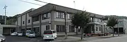 Otobe Town hall | |
 Flag  Seal | |
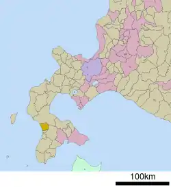 Location of Otobe in Hokkaido (Hiyama Subprefecture) | |
  Otobe Location in Japan | |
| Coordinates: 41°58′N 140°8′E | |
| Country | Japan |
| Region | Hokkaido |
| Prefecture | Hokkaido (Hiyama Subprefecture) |
| District | Nishi |
| Government | |
| • Mayor | Tsutomu Terashima |
| Area | |
| • Total | 162.55 km2 (62.76 sq mi) |
| Population (September 30, 2016) | |
| • Total | 3,925 |
| • Density | 24/km2 (63/sq mi) |
| Time zone | UTC+09:00 (JST) |
| City hall address | 388 Midoricho, Otobe, Nishi District, Hokkaido 043-0103 |
| Website | www |
| Symbols | |
| Flower | Lilium |
| Tree | Cryptomeria |
As of September 2016, the town has an estimated population of 3,925, and a density of 24 persons per km². The total area is 162.55 km².
Geography
Otobe is located on the western of the Oshima Peninsula and faces the Sea of Japan.
The name came from Ainu word that means "The river with a marsh in its estuary". This river is Hime River, which flows through the town.[1]
Neighboring towns
- Hiyama Subprefecture
- Oshima Subprefecture
History
- 1902: Otobe became a Second Class Village.[2]
- 1965: Otobe Village became Otobe Town.
Education
- Junior high school
- Otobe Junior High School
- Elementary schools
- Otobe Elementary School
- Sakaehama Elementary School
- Meiwa Elementary School
References
External links
 Media related to Otobe, Hokkaidō at Wikimedia Commons
- Official Website (in Japanese)
|  | |||||||||||
|
| ||||||||||||
| ||||||||||||
| ||||||||||||
| ||||||||||||
| ||||||||||||
| ||||||||||||
| ||||||||||||
| ||||||||||||
| ||||||||||||
| ||||||||||||
| ||||||||||||
| ||||||||||||

Authority control  | |
|---|---|
| General | |
| National libraries | |
This article is issued from Wikipedia. The text is licensed under Creative Commons - Attribution - Sharealike. Additional terms may apply for the media files.