Parkland County
Parkland County is a municipal district in central Alberta, Canada. Located west of Edmonton in Census Division No. 11, its municipal office, Parkland County Centre, is located 0.25 km (0.16 mi) north of the Town of Stony Plain on Highway 779.[3]
Parkland County | |
|---|---|
 Logo | |
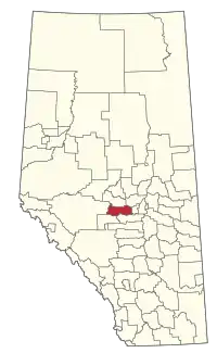 Location within Alberta | |
| Coordinates: 53°31′48″N 114°00′23″W | |
| Country | Canada |
| Province | Alberta |
| Region | Edmonton Metropolitan Region |
| Census division | 11 |
| Established | 1969 |
| Incorporated | 1969 |
| Government | |
| • Mayor | Allan Gamble |
| • Governing body | Parkland County Council
|
| • Administrative office | north of Stony Plain |
| Area (2016)[2] | |
| • Land | 2,390.23 km2 (922.87 sq mi) |
| Population (2016)[2] | |
| • Total | 32,097 |
| • Density | 13.4/km2 (35/sq mi) |
| Time zone | UTC−7 (MST) |
| • Summer (DST) | UTC−6 (MDT) |
| Website | parklandcounty |
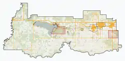


History
- 2021 wildfire
In May 2021, a wildfire, originating in Tomahawk,[4] was reported. Evacuation orders, spanning from Highway 22 to the west, Township Road 524 to the north, Range Road 63 to the east, and Township Road 510 to the south, were issued on May 5.[5]
Geography
Communities and localities
|
The following urban municipalities are surrounded by Parkland County.[6][7] |
The following hamlets are located within Parkland County.[7]
|
The following localities are located within Parkland County.[8]
- Localities
|
|
|
|
- Other places
- Westlake Estates (designated place)
Demographics
In the 2016 Census of Population conducted by Statistics Canada, Parkland County recorded a population of 32,097 living in 11,615 of its 12,910 total private dwellings, a 5% change from its 2011 population of 30,568. With a land area of 2,390.23 km2 (922.87 sq mi), it had a population density of 13.4/km2 (34.8/sq mi) in 2016.[2]
In the 2011 Census, Parkland County had a population of 30,568 living in 10,931 of its 12,150 total dwellings, a 4.6% change from its 2006 adjusted population of 29,220. With a land area of 2,387.68 km2 (921.89 sq mi), it had a population density of 12.8/km2 (33.2/sq mi) in 2011.[9]
The population of Parkland County according to its 2009 municipal census is 30,089.[10]
Economy
Parkland County's economic development hub is the Acheson Industrial Area.[11] Its 4,000 hectares (9,900 acres) of land[11] is home to over 200 businesses.[12]
Attractions
- Wagner Natural Area
- Clifford E. Lee Nature Sanctuary
- University of Alberta Botanic Garden
- Golf courses: Trestle Creek Golf Resort www.trestlecreek.ca, Cougar Creek Golf Resort, Deer Meadows Golf Course, Devon Valley Golf Course, Edmonton Springs Golf, resort, Grouse Nest Golf Course, Indian Lakes Golf Course, Les Furbur designed Ironhead Golf & Country Club on the Paul First Nation www.ironheadgolfcourse.ca, The Links Spruce Grove, Pineridge Golf Course, The Ranch Golf & Country Club, Stony Plain Golf Course, Whitewood Links Golf & RV Park
- Lakes: Jackfish Lake, Hasse Lake
- Regional Parks and Campgrounds: Chickakoo Lake Park, KoKoMoKo, Ascot Beach Park, Rich's Point Park, Muir Lake Park, Constable Chelsey Robinson Day Use Park
- Wabamun Provincial Park
- Pembina River Provincial Park
References
- "Municipal Officials Search". Alberta Municipal Affairs. May 9, 2019. Retrieved October 1, 2021.
- "Population and dwelling counts, for Canada, provinces and territories, and census subdivisions (municipalities), 2016 and 2011 censuses – 100% data (Alberta)". Statistics Canada. February 8, 2017. Retrieved February 8, 2017.
- Parkland County. "Location". Archived from the original on 2008-07-05. Retrieved 2007-02-15.
- "Parkland County wildfire west of Edmonton grows beyond 1,000 hectares as evacuation order remains in place". Global News. Retrieved 2021-05-07.
- Snowdon, Wallis. "Rain expected to help in fight against fast-moving wildfire west of Edmonton". Canadian Broadcasting Corporation (CBC).
- "Spruce Grove, City (Census Subdivision), Alberta". Statistics Canada. 2012-06-20. Retrieved 2012-08-13.
- "Specialized and Rural Municipalities and Their Communities" (PDF). Alberta Municipal Affairs. January 6, 2021. Retrieved September 29, 2021.
- "Standard Geographical Classification (SGC) 2006, Economic Regions: 4811034 - Parkland County, geographical codes and localities, 2006". Statistics Canada. 2010-03-05. Retrieved 2012-08-12.
- "Population and dwelling counts, for Canada, provinces and territories, and census subdivisions (municipalities), 2011 and 2006 censuses (Alberta)". Statistics Canada. February 8, 2012. Retrieved February 8, 2012.
- "Alberta 2009 Official Population List" (PDF). Alberta Municipal Affairs. September 15, 2009. Retrieved September 12, 2010.
- "Acheson Industrial Area". Parkland County. Archived from the original on 2011-08-26. Retrieved 2011-10-15.
- "History of Acheson". Acheson Business Association. Archived from the original on 2012-04-25. Retrieved 2011-10-15.
External links
Places adjacent to Parkland County | |
|---|---|




.svg.png.webp)

Authority control | |
|---|---|
| General | |
| National libraries | |