Dandenong Valley Highway
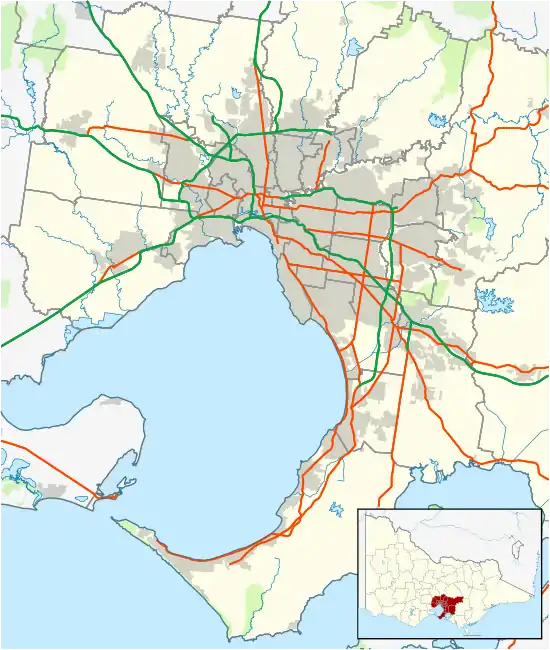
The Dandenong Valley Highway is an urban highway stretching almost 40 kilometres from Bayswater in Melbourne's eastern suburbs to Frankston in the south. This name covers many consecutive streets and is not widely known to most drivers, as the entire allocation is still best known as by the names of its constituent parts: Stud Road, Foster Street, Dandenong-Frankston Road, Dandenong Road West and Fletcher Road. This article will deal with the entire length of the corridor for sake of completion, as well to avoid confusion between declarations.
Dandenong Valley Highway Also known as Stud Road, Foster Street, Dandenong-Frankston Road, Dandenong Road West, Fletcher Road | |
|---|---|
 | |
Heatherton Road and Stud Road, Dandenong | |
  North end South end | |
| Coordinates |
|
| General information | |
| Type | Highway |
| Length | 37 km (23 mi)[1] |
| Route number(s) |  State Route 9 (1965-present) State Route 9 (1965-present)(Wantirna–Frankston) |
| Major junctions | |
| North end |  Mountain Highway Mountain HighwayBayswater, Melbourne |
| South end |  Nepean Highway Nepean HighwayFrankston, Melbourne |
| Location(s) | |
| Major suburbs | Scoresby, Rowville, Dandenong, Carrum Downs |
| Highway system | |
The traffic on the highway has been significant over the years with the worst bottlenecks at Burwood Highway, Ferntree Gully Road, Wellington Road, Princes Highway, and Thompsons Road, but since the opening of the EastLink, the traffic burden has significantly reduced along the highway with the north–south tollway, opening to traffic on 29 June 2008.
Route
Stud Road starts at the intersection with Mountain Highway in Bayswater and heads south as a four-lane, dual-carriageway road, crossing Burwood Highway at Wantirna South (and the beginning of Dandenong Valley Highway), where it widens to a six-lane, dual-carriageway road (sharing a dedicated bus lane on-and-off) and continues south through Scoresby to Rowville, crossing Wellington Road and narrowing back to a four-lane, dual-carriageway road. It continues south to Dandenong, narrowing further to a four-lane, single-carriageway road south past David Street, changes names to Foster Street south of Clow Street, to the intersection with Lonsdale Street through central Dandenong. Running concurrent along Lonsdale Street, it resumes running south along Dandenong-Frankston Road as a four-lane, dual-carriageway road through Dandenong South and Carrum Downs, where it eventually crosses west under the Frankston railway line (at the end of Dandenong Valley Highway) as Overton Road, then turns immediately south along Dandenong Road West as a dual-lane single-carriageway road, all the way along Fletcher Road, where it briefly becomes a four-lane, dual-carriageway road again before it terminates at Nepean Highway in Frankston.
History
The elimination of the railway crossing where Dandenong-Frankston Road crossed the Pakenham railway line in Dandenong commenced in 1956, carried out by the Dandenong Shire Council, with assistance from Victorian Railways and the Country Roads Board,[2] and completed in 1957, with the eastern half of a four-lane overpass over the railway completed and open to traffic in September, and the western half completed not long afterwards.[3]
Dandenong Valley Highway (as its constituent roads) was signed as State Route 9 between Wantirna and Frankston in 1965. It was re-routed from Dandenong Road East and Beach Street through Frankston to its current alignment when the Beach Street railway crossing was eliminated in 1991.
The passing of the Road Management Act 2004[4] granted the responsibility of overall management and development of Victoria's major arterial roads to VicRoads: in 2004, VicRoads declared the road as Dandenong Valley Highway (Arterial #6090), from Burwood Highway in Wantirna South to Wells Road crossing underneath the Frankston railway line in Frankston,[5] while re-declaring the remaining roads within the corridor as Stud Road (Arterial #5796),[6] Klauer Road (today Klauer Street, Wells Road and Dandenong Road West) (Arterial #5159)[7] and Fletcher Road (Arterial #5974),[8] however all roads are still presently known (and signposted) as their constituent parts.
Major intersections
| LGA | Location[1][5][6][7][8] | km[1] | mi | Destinations | Notes |
|---|---|---|---|---|---|
| Knox | Bayswater | 0.0 | 0.0 | Mountain Highway (State Route 28) – Wantirna, Bayswater | Northern terminus of Stud Road |
| Wantirna | 1.1 | 0.68 |  Boronia Road (State Route 36) – Wantirna, Ringwood, Boronia Boronia Road (State Route 36) – Wantirna, Ringwood, Boronia | State Route 9 continues west along Boronia Road towards Wantirna | |
| Wantirna South | 3.0 | 1.9 |  Burwood Highway (State Route 26) – Ferntree Gully, Belgrave, City Burwood Highway (State Route 26) – Ferntree Gully, Belgrave, City | Northern terminus of Dandenong Valley Highway (declared) | |
| 4.0 | 2.5 |  High Street Road (State Route 24) – Glen Waverley, Wantirna South High Street Road (State Route 24) – Glen Waverley, Wantirna South | |||
| Scoresby | 6.4 | 4.0 |  Ferntree Gully Road (State Route 22) – Oakleigh, Ferntree Gully Ferntree Gully Road (State Route 22) – Oakleigh, Ferntree Gully | ||
| Rowville | 7.8 | 4.8 | Kelletts Road – Ferntree Gully | ||
| 9.8 | 6.1 |   Wellington Road (State Route 18 west/C413 east) – Mulgrave, Oakleigh, Lysterfield, Emerald Wellington Road (State Route 18 west/C413 east) – Mulgrave, Oakleigh, Lysterfield, Emerald | |||
| 9.9 | 6.2 | Bergins Road – Endeavour Hills, Doveton | |||
| Greater Dandenong | Dandenong North | 13.4 | 8.3 |  Monash Freeway (M1) – Pakenham, Warragul, Chadstone, City Monash Freeway (M1) – Pakenham, Warragul, Chadstone, City | |
| Dandenong | 14.6 | 9.1 |  Heatherton Road (State Route 14) – Noble Park, Endeavour Hills Heatherton Road (State Route 14) – Noble Park, Endeavour Hills | ||
| 16.3 | 10.1 | Clow Street – Dandenong, Doveton | Stud Road north, Foster Street south | ||
| 17.0 | 10.6 |  Lonsdale Street (Princes Highway) (National Alt Route 1 north) – Oakleigh, Springvale Lonsdale Street (Princes Highway) (National Alt Route 1 north) – Oakleigh, Springvale Foster Street (Cheltenham Road) (State Route 10 west) – Keysborough, Mentone, Black Rock Foster Street (Cheltenham Road) (State Route 10 west) – Keysborough, Mentone, Black Rock | Concurrency with route National Alt Route 1 Foster Street east of Lonsdale Street, Dandenong-Frankston Road south of Lonsdale Street | ||
| 17.8 | 11.1 | Lonsdale Street (Princes Highway) (National Alt Route 1 east) – Narre Warren, Pakenham | |||
| 18.1 | 11.2 | Gippsland railway line | |||
| Dandenong South | 18.7 | 11.6 |  Dandenong Bypass (State Route 49) – Keysborough, Clayton Dandenong Bypass (State Route 49) – Keysborough, Clayton | ||
| 19.8 | 12.3 |  Greens Road (State Route 12) – Mordialloc, Keysborough Greens Road (State Route 12) – Mordialloc, Keysborough | |||
| Frankston | Carrum Downs | 26.6 | 16.5 |  Thompson Road (State Route 6) – Carrum, Cranbourne, Clyde North Thompson Road (State Route 6) – Carrum, Cranbourne, Clyde North | |
| 31.7 | 19.7 |  Mornington Peninsula Freeway (M11) – Chelsea Heights, Mount Martha, Rosebud Mornington Peninsula Freeway (M11) – Chelsea Heights, Mount Martha, Rosebud | |||
| Frankston North | 32.3 | 20.1 | Seaford Road (west) – Seaford Ballarto Road (east) – Skye | ||
| Seaford | 35.0 | 21.7 |  Frankston Freeway (M3) – Ringwood, Frankston South, City Frankston Freeway (M3) – Ringwood, Frankston South, City | ||
| 35.2 | 21.9 | Skye Road (east) – Frankston Dandenong Road East (south) – Frankston | Dandenong-Frankston Road north, Overton Road west | ||
| Seaford-Frankston boundary | Frankston railway line | ||||
| Frankston | Overton Road (west) – Frankston Wells Road (north) – Seaford | Overton Road east, Dandenong Road West south Southern terminus of Dandenong Valley Highway (declared) | |||
| 36.4 | 22.6 | Fletcher Road | Dandenong Road West north, Fletcher Road west | ||
| 36.8 | 22.9 | Nepean Highway (State Route 3) – Mornington, Portsea, Mordialloc, City | Western terminus of Fletcher Road | ||
1.000 mi = 1.609 km; 1.000 km = 0.621 mi
| |||||
See also
 Australian Roads portal
References
- Google (27 October 2021). "Dandenong Valley Highway" (Map). Google Maps. Google. Retrieved 27 October 2021.
- "Country Roads Board Victoria. Forty-Fourth Annual Report: for the year ended 30 June 1957". Country Roads Board of Victoria. Melbourne: Victorian Government Library Service. 21 November 1957. p. 25.
- "Country Roads Board Victoria. Forty-Fifth Annual Report: for the year ended 30 June 1958". Country Roads Board of Victoria. Melbourne: Victorian Government Library Service. 19 November 1958. p. 30.
- State Government of Victoria. "Road Management Act 2004" (PDF). Government of Victoria. Archived (PDF) from the original on 19 October 2021. Retrieved 19 October 2021.
- VicRoads. "VicRoads – Register of Public Roads (Part A) 2015" (PDF). Government of Victoria. pp. 947–8. Archived from the original on 1 May 2020. Retrieved 19 October 2021.
- VicRoads. "VicRoads – Register of Public Roads (Part A) 2015" (PDF). Government of Victoria. p. 757. Archived from the original on 1 May 2020. Retrieved 19 October 2021.
- VicRoads. "VicRoads – Register of Public Roads (Part A) 2015" (PDF). Government of Victoria. p. 274. Archived from the original on 1 May 2020. Retrieved 19 October 2021.
- VicRoads. "VicRoads – Register of Public Roads (Part A) 2015" (PDF). Government of Victoria. p. 916. Archived from the original on 1 May 2020. Retrieved 19 October 2021.