Yarra Bank Highway
Yarra Bank Highway is a short urban highway in central Melbourne, Australia. It runs parallel to the Yarra River and provides an important alternate route to CityLink's Domain and Burnley Tunnels, used by trucks carrying hazardous loads prohibited from the tunnels, and provides another route when the tunnels are closed for maintenance. Prior to the construction of CityLink, the highway provided the main link between the Monash Freeway and the West Gate Freeway. This name covers many consecutive streets and is not widely known to most drivers, as the entire allocation is still best known as by the names of its constituent parts: Power Street, City Road, Alexandra Avenue and Olympic Boulevard. This article will deal with the entire length of the corridor for sake of completion, as well to avoid confusion between declarations.
Yarra Bank Highway Power Street, City Road, Alexandra Avenue, Olympic Boulevard | |
|---|---|
  West end East end | |
| Coordinates |
|
| General information | |
| Type | Highway |
| Length | 2.1 km (1.3 mi)[1] |
| Route number(s) |  State Route 20 (1989–present) State Route 20 (1989–present)(Southbank-Melbourne) |
| Former route number |  State Route 2 (1965-1989) State Route 2 (1965-1989)(Southbank-Melbourne) |
| Tourist routes |  Tourist Drive 2 (1989–present) Tourist Drive 2 (1989–present)(Southbank-Melbourne) |
| Major junctions | |
| West end |  West Gate Freeway West Gate FreewaySouthbank, Melbourne |
| |
| East end | Olympic Boulevard Melbourne |
| Highway system | |
Route
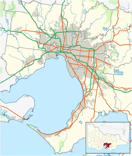
Yarra Bank Highway starts at the intersection of Power and Sturt Streets (southbound) and the West Gate Freeway off-ramp at Power Street (northbound), running north as a five-lane (three northbound, two southbound) single-carriageway road, where it nearly immediately intersects with and changes name to City Road, heading east as a six-lane, dual-carriageway road through the St Kilda Road underpass and the Arts Centre, where it changes name to Alexandra Avenue and narrows to a five-lane (three eastbound, two westbound) single-carriageway road. It intersects with and changes name to Olympic Boulevard and crosses the Yarra River over the Swan Street Bridge, to terminate immediately afterwards at the intersection with Batman Avenue on the river's eastern bank.
History
With construction starting on the Swan Street Bridge in 1946, traffic levels along Alexandra Avenue were predicted to rise and an underpass underneath St Kilda Road was proposed in 1948,[2] to replace the existing at-grade intersection with City Road; funds were set aside to plan an underpass along Alexandra Avenue in April 1952.[3] The passing of the Melbourne (St Kilda-Road Underpass) Lands Bill 1969[4] through the Parliament of Victoria on 22 April 1969, converted Crown Land in the area to a road reserve, enabling Melbourne and Metropolitan Board of Works (MMBW) to award a A$2 million contract to Leighton Contractors. The Melbourne and Metropolitan Tramways Board installed new tracks along Nolan Street (today Southbank Boulevard) to reach Sturt Street in May 1970 to divert away from the former alignment along City Road where it met the new overpass. Construction on the overpass began in April 1970, and was eventually completed and opened to traffic by the end of 1971. Responsibility for the underpass was transferred from the MMBW to the Country Roads Board on 1 July 1974.[5] The passing of the Melbourne (Snowden Gardens) Land Act 1975 on 2 May 1975[6] allowed the remaining Crown land between the underpass and the Yarra River to be reserved as a site for the Arts Centre Melbourne, with Hamer Hall eventually completed there in 1982.
Yarra Bank Highway (as its constituent roads) was signed as State Route 2 along City Road and Alexandra Avenue in 1965; it was replaced by Tourist Drive 2 in 1989. State Route 20 was also signed along City Road, Alexandra Avenue and Swan Street (today Olympic Boulevard) in 1989.
The passing of the Road Management Act 2004[7] granted the responsibility of overall management and development of Victoria's major arterial roads to VicRoads: in 2004, VicRoads declared Yarra Bank Highway (Arterial #6240) beginning at the ramps from the West Gate Freeway in Southbank and ending at Olympic Boulevard in Melbourne,[8] however the road is still presently known (and signposted) as its constituent parts.
The western section of Swan Street between Alexandra Avenue and Punt Road was renamed to Olympic Boulevard in November 2006, in tribute to the 1956 Melbourne Olympics.[9]
Major intersections
Yarra Bank Highway is entirely contained within the City of Melbourne local government area.
| Location[1][8] | km[1] | mi | Destinations | Notes | |
|---|---|---|---|---|---|
| Southbank | 0.0 | 0.0 | Sturt Street | One way, southbound only | |
| 0.1 | 0.062 | West Gate Freeway (M1 west) – Laverton North, Werribee CityLink (M1 east) – Kooyong, Chadstone CityLink (M1 east) – Kooyong, Chadstone | Westbound and eastbound exits to Power Street northbound only Western terminus of highway | ||
| 0.5 | 0.31 | City Road (State Route 20/Tourist Route 2 west, east) – Laverton North, Werribee Power Street (north) – Southbank | Western terminus of concurrency with Tourist Route 2 | ||
| Melbourne | 1.6 | 0.99 | Linlithgow Avenue, to  St Kilda Road (State Route 3) – City, St Kilda St Kilda Road (State Route 3) – City, St Kilda | ||
| 1.9 | 1.2 | Alexandra Parade (Tourist Route 2) – South Yarra, Burnley | No right turn from Alexandra Parade into Olympic Boulevard eastbound Eastern terminus of concurrency with Tourist Route 2 | ||
| Yarra River | 2.0 | 1.2 | Swan Street Bridge | ||
| Melbourne | 2.1 | 1.3 | Batman Avenue – City, to CityLink (M1 east) – Kooyong, Chadstone | ||
| Olympic Boulevard (State Route 20) – Burnley, Camberwell | Eastern terminus of highway, State Route 20 continues east along Olympic Boulevard | ||||
1.000 mi = 1.609 km; 1.000 km = 0.621 mi
| |||||
References
- Google (13 November 2021). "Yarra Bank Highway" (Map). Google Maps. Google. Retrieved 13 November 2021.
- "Town and Country Planning Board Victoria. Third Annual Report: for the year ended 30 June 1948". Town and Country Planning Board of Victoria. Melbourne: Victorian Government Library Service. 30 September 1948. pp. 11–2.
- "£210,000 Plan for Underpass". The Age. Melbourne: National Library of Australia. 23 April 1952. p. 3. Retrieved 13 November 2021.
- Melbourne (St Kilda-Road Underpass) Lands Bill 1969
- "Country Roads Board Victoria. Sixty-First Annual Report: for the year ended 30 June 1974". Country Roads Board of Victoria. Melbourne: Victorian Government Library Service. 1 November 1974. p. 4.
- Melbourne (Snowden Gardens) Land Act 1975
- State Government of Victoria. "Road Management Act 2004" (PDF). Government of Victoria. Archived (PDF) from the original on 19 October 2021. Retrieved 19 October 2021.
- VicRoads. "VicRoads – Register of Public Roads (Part A) 2015". Government of Victoria. p. 964. Archived from the original on 1 May 2020. Retrieved 19 October 2021.
- City of Melbourne. "PROPOSED RENAMING OF SWAN STREET, MELBOURNE (BETWEEN BATMAN AVENUE AND PUNT ROAD) TO OLYMPIC BOULEVARD" (PDF). melbourne.vic.gov.au. Archived from the original (PDF) on 4 August 2008. Retrieved 9 July 2008.
See also
 Australian roads portal