Docklands Highway
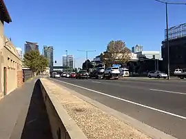
Docklands Highway is a 12 kilometres (7 mi) highway with a mix of many arterial roads in inner western Melbourne, Australia.
Docklands Highway Wurundjeri Way, Dudley Street, Footscray Road, Whitehall Street, Francis Street | |
|---|---|
 | |
| General information | |
| Type | Highway |
| Length | 12 km (7.5 mi) |
| Route number(s) |
|
| Former route number |
|
| Major junctions | |
| West end |   Geelong Road, Geelong Road,Brooklyn, Melbourne |
| |
| East end |  Montague Street, South Melbourne, Melbourne Montague Street, South Melbourne, Melbourne |
| Location(s) | |
| Major suburbs | Docklands, West Melbourne, Seddon, Yarraville |
| Highway system | |

Major intersections
| LGA | Location | km | mi | Destinations | Notes |
|---|---|---|---|---|---|
| Geelong Road | |||||
| Millers Road | |||||
 Williamstown Road Williamstown Road | |||||
 Hyde Street Hyde Street | |||||
 Somerville Road Somerville Road | |||||
| Whitehall Street | |||||
 Napier Street Napier Street | |||||
| MacKenzie Road/Sims Street | |||||
| Dock Link Road | |||||
| Appleton Dock Road – West Melbourne | |||||
 CityLink – Melbourne Airport, Port Melbourne CityLink – Melbourne Airport, Port Melbourne | |||||
| Docklands Drive (west) – Docklands Harbour Esplanade (south) – Docklands | |||||
 Dudley Street Dudley Street | |||||
| Bourke Street | |||||
| Flinders Street | |||||
| Lorimer Street | |||||
 West Gate Freeway – Geelong, Dandenong West Gate Freeway – Geelong, Dandenong | |||||
| Montague Street |
See also
 Australian Roads portal





This article is issued from Wikipedia. The text is licensed under Creative Commons - Attribution - Sharealike. Additional terms may apply for the media files.