N850 highway (Philippines)
National Route 850 (N850) is a 260.25 km (161.71 mi), two-four lane, circumferential national secondary route that forms part of the Philippine highway network. It connects the whole island of Bohol.[1][2][3] The route is composed of Tagbilaran North Road from Tagbilaran to Trinidad and Tagbilaran East Road from Trinidad to Tagbilaran again.
.svg.png.webp) | ||||
|---|---|---|---|---|
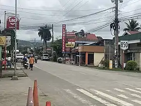 Reassurance marker of N850 in Guindulman, Bohol | ||||
| Route information | ||||
| Length | 260.25 km (161.71 mi) | |||
| Component highways | N850 (Tagbilaran North Road)
N850 (Tagbilaran East Road) | |||
| Major junctions | ||||
| Southwest end | Kilometer 0 in Tagbilaran | |||
| Southwest end | Kilometer 0 in Tagbilaran | |||
| Location | ||||
| Provinces | Bohol | |||
| Municipalities | Cortes, Maribojoc, Loon, Calape, Tubigon, Clarin, Inabanga, Buenavista, Getafe, Talibon, Ubay, Alicia, Candijay, Guindulman, Duero, Jagna, Garcia Hernandez, Valencia, Dimiao, Lila, Loay, Bohol, Alburquerque, Baclayon | |||
| Major cities | Tagbilaran | |||
| Highway system | ||||
| ||||
.svg.png.webp)
Route description
Tagbilaran to Trinidad
The route starts as Tagbilaran North Road. After reaching Trinidad, the road ends in a three-way intersection with Loay Interior Road and Tagbilaran East Road.[4]
Trinidad to Tagbilaran
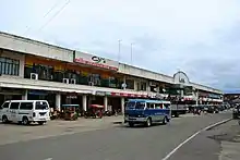
Tagbilaran East Road in Ubay.
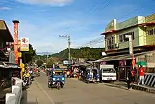
Tagbilaran East Road, a component of N850 in Jagna.
The route continues as Tagbilaran East Road. After reaching tagbilaran again it ends in the kilometer 0 of Bohol.[4]
Incidents
- This highway had many bridges and sections of Tagbilaran North Road and Tagbilaran East Road damaged during the 2013 Bohol earthquake.[5] A few bridges were reconstructed with the Mabey Compact 200.[6]
References
- "Bohol 1st". www.dpwh.gov.ph. Retrieved 2021-09-12.
- "Bohol 2nd". www.dpwh.gov.ph. Retrieved 2021-09-12.
- "Bohol 3rd". www.dpwh.gov.ph. Retrieved 2021-09-12.
- "Road and Bridge Inventory | Department of Public Works and Highways". www.dpwh.gov.ph. Retrieved 2021-09-12.
- "List of major/secondary roads and bridges affected by Central Visayas earthquake | GOVPH". Official Gazette of the Republic of the Philippines. Retrieved 2021-09-12.
- "Bohol Island Earthquake Emergency Bridge | Mabey - English". www.mabeybridge.com. Retrieved 2021-09-12.
| National primary roads |
|  | ||||||
|---|---|---|---|---|---|---|---|---|
| National secondary roads |
| |||||||
See also: Philippine expressway network | ||||||||

This article is issued from Wikipedia. The text is licensed under Creative Commons - Attribution - Sharealike. Additional terms may apply for the media files.