Lipová-lázně
Lipová-lázně (German: Bad Lindewiese, until 1960 Dolní Lipová) is a spa municipality and village in Jeseník District in the Olomouc Region of the Czech Republic. it has about 2,100 inhabitants.
Lipová-lázně | |
|---|---|
_-_hlavn%C3%AD_silnice_(II-369).JPG.webp) Main street | |
 Flag  Coat of arms | |
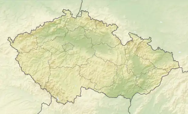  Lipová-lázně Location in the Czech Republic | |
| Coordinates: 50°13′40″N 17°8′26″E | |
| Country |  Czech Republic Czech Republic |
| Region | Olomouc |
| District | Jeseník |
| First mentioned | 1290 |
| Area | |
| • Total | 44.37 km2 (17.13 sq mi) |
| Elevation | 498 m (1,634 ft) |
| Population (2020-01-01[1]) | |
| • Total | 2,118 |
| • Density | 48/km2 (120/sq mi) |
| Time zone | UTC+1 (CET) |
| • Summer (DST) | UTC+2 (CEST) |
| Postal code | 790 61, 790 63 |
| Website | www |
Lipová-lázně lies approximately 5 kilometres (3 mi) west of Jeseník, 71 km (44 mi) north of Olomouc, and 195 km (121 mi) east of Prague. It lies near the Hrubý Jeseník mountain range, and the municipality includes the peak of Šerák (1,351 m).
Administrative parts
Village of Horní Lipová and settlement of Bobrovník are administrative parts of Lipová-lázně.
Spa
The municipality is known for its spa, established in 1837 by Johann Schroth.
History
The settlement was first mentioned in 1290, when it became part of the newly formed Duchy of Nysa within fragmented Piast-ruled Poland. Later on, it passed under Bohemian suzerainty, and following the duchy's dissolution in 1850, it was incorporated directly into Bohemia. Following World War I, from 1918, it formed part of Czechoslovakia, and from 1938 to 1945 it was a part of Reichsgau Sudetenland under Nazi Germany. During the German occupation (World War II), the occupiers operated the E797 forced labour subcamp of the Stalag VIII-B/344 prisoner-of-war camp in Lipová-lázně, and E333 and E380 subcamps in Horní Lipová.[2]
Notable people
- Johann Schroth (1798–1856), Austrian naturopath; worked and died here

References
- "Population of Municipalities – 1 January 2020". Czech Statistical Office. 2020-04-30.
- "Working Parties". Lamsdorf.com. Archived from the original on 29 October 2020. Retrieved 12 November 2021.
- "Miasta partnerskie". krapkowice.pl (in Polish). Gmina Krapkowice. Retrieved 2020-09-18.
 |
Wikimedia Commons has media related to Lipová-lázně. |
Authority control  | |
|---|---|
| General | |
| National libraries | |