Goulburn Valley Highway
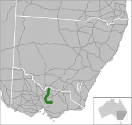
The Goulburn Valley Highway[2] is a highway located in Victoria, Australia. The section north of the Hume Freeway is part of the Melbourne to Brisbane National Highway (together with Hume Freeway) and is the main link between these two cities as well as a major link between Victoria and inland New South Wales. It is also the most direct route between Melbourne and the major regional centre of Shepparton in Victoria (via the Hume Freeway).
Goulburn Valley Highway | |
|---|---|
 | |
| General information | |
| Type | Highway |
| Length | 256 km (159 mi)[1] |
| Route number(s) |
|
| Former route number |
|
| Major junctions | |
| Northeast end |  Newell Highway Newell HighwayVIC/NSW border |
| Southeast end | Eildon Road Eildon, Victoria |
| Location(s) | |
| Major settlements | Strathmerton, Shepparton, Nagambie, Seymour, Yea, Alexandra |
| Highway system | |


Route
The highway roughly follows the course of the Goulburn River, a tributary of the Murray River. The Highway serves the fruit and vegetable growing areas of the Goulburn Valley in Victoria, one of Australia's most productive agricultural regions.
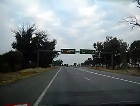
The highway runs from Eildon to Seymour as a two lane single carriageway sealed road with shoulders. The section from the Hume Freeway to Arcadia via Nagambie has been fully converted into a dual carriageway and has been renamed as the Goulburn Valley Freeway. The freeway upgrade has made sections of the original Goulburn Valley Highway redundant, either incorporated into the new freeway or acting as local access roads. The freeway section is covered with a speed limit of 110 km/h, the standard speed limit for rural freeways in Australia. Between Arcadia and Tocumwal the highway is a two lane single carriageway but with tactile road lines, wide shoulders and small sections of 3 or 4 lane single carriageway road for overtaking. The Goulburn Valley Highway crosses the Murray River at Tocumwal to join the Newell Highway in New South Wales.
History
The passing of the Highways and Vehicles Act of 1924[3] through the Parliament of Victoria provided for the declaration of State Highways, roads two-thirds financed by the State government through the Country Roads Board (later VicRoads). The Goulburn Valley Highway was declared a State Highway in the 1946/47 financial year,[4] from Seymour via Murchison and Shepparton to Strathmerton (for a total of 88 miles); before this declaration, these road were referred to as Goulburn Valley Road, Murchison-Shepparton Road and Shepparton-Numurkah-Cobram Road.[5] In the 1959/60 financial year, the eastern section from Eildon via Alexandra and Yea to Seymour was added,[6] along the Upper Goulburn Road (from Eildon to Trawool, where it crossed the Goulburn River), and then along Seymour-Yea Road to Seymour.[6] The last section, from Yarroweyah to the border with NSW just outside Tocumwal, was added in 1983,[7] along the Benalla-Tocumwal Road north of the Murray Valley Highway.
The Goulburn Valley Highway was signed as National Route 39 between Seymour and Tocumwal in 1965, and State Route 168 between Seymour and Eildon in 1986.[8] The Whitlam Government introduced the federal National Roads Act 1974,[9] where roads declared as a National Highway were still the responsibility of the states for road construction and maintenance, but were fully compensated by the Federal government for money spent on approved projects.[9]: S7 As an important interstate link between the capitals of Victoria and Queensland, the Goulburn Valley Highway was declared a National Highway between Seymour and Tocumwal in 1992.[10] With Victoria's conversion to the newer alphanumeric system in the late 1990s, this was updated to route A39 between Seymour and Tocumwal, and replaced by B340 from Seymour to Eildon. As stages of the highway north of Seymour are successively converted to freeway-standard, these sections are updated from route A39 to route M39.
The passing of the Road Management Act 2004[11] granted the responsibility of overall management and development of Victoria's major arterial roads to VicRoads: in 2011, VicRoads re-declared this road as Goulburn Valley Freeway (Freeway #1640), beginning in Seymour and ending in Arcadia,[12] while re-declaring the remnants between Eildon and the border with New South Wales as Goulburn Valley Highway (Arterial #6640).[13]
Timeline of upgrade
- 2001 - Hume Freeway to Nagambie. 16 km opened in April 2001, at a cost of $A53m. The opening ceremony was held in a new south-bound rest area and was attended by representatives of the local Taungurung Aboriginal People, who referred to the significance of the relocated 'scarred tree', which had been relocated as part of the project.[14]
- 2003 - Murchison East deviation. 18 km opened to traffic on 18 February 2003, almost eleven months early, at a cost of $A88.9m.[15]
- 2008 – 10 km Arcadia section duplication, from north of the Murchison-Violet Town Road interchange to Gribben Road, south of Shepparton. Opened in June 2008, at a cost of A$40.5m.[16]
- 2013 - Nagambie bypass. 17 km bypass opened at the end of April, 2013.[17]
Arcadia duplication
The duplication was a $40.55 million project funded by the Australian Government as part of its Auslink Program. The works involved duplication of 10 km of the existing Goulburn Valley Highway between the Murchison East deviation and the proposed Shepparton Bypass, just north of Ross Road. It incorporates four at-grade intersections, frontage access roads, a rest area with full facilities, and wire rope safety barriers.
The Arcadia section runs adjacent to the Calder Woodburn Memorial Avenue of Honour. A Conservation Management Plan was developed in consultation with Heritage Victoria to ensure that impact on the Avenue of Honour was minimised. The plans included measures to enhance and highlight the avenue of trees. The project was started in June 2006, open to traffic in February 2008, with final completion of all works in April 2008.
The highway carries an estimated 6,500 vehicles per day, including more than 2,000 commercial vehicles.
Nagambie bypass
The Nagambie Bypass, funded as part of the Auslink 2 (2009–2014) Federal Government infrastructure program, bypasses the town of Nagambie to the east. Funding was announced in May 2009,[18] and construction commenced in December 2009. The bypass opened to traffic in April 2013.[17]
Costed at $222 million, $177.6 million was contributed by the Australian Government, with the remaining $44.4 million from the State Government.[19] The project was made up of two sections: duplicating the existing highway north of Nagambie for 3.5 km between Kirwans Bridge-Longwood Road and Moss Road (completed in November 2011), and the 13.5 km bypass road from Mitchellstown Road to Kirwans Bridge-Longwood Road.[19]
Shepparton bypass
An alignment for the Shepparton bypass has been decided, connecting with the northern terminus of the existing Goulburn Valley Freeway in Arcadia, heading northwest to cross the Goulburn River at Toolamba, travel west and then north around Mooroopna, to rejoin the existing highway north of Congupna.[20]
It was proposed that the Shepparton Bypass would be funded by Auslink 2 (2009–2014);[21] the 2017/18 State Budget allocated $10.2 million over three years to undertake preparatory works and land acquisition,[22] and a consultation was held with the community for its initial stage in 2018. The current priority is Stage 1, a single carriageway with a lane in each direction extending from the Midland Highway west of Mooroopna to the Goulburn Valley Highway via an upgraded Wanganui Road in Shepparton North, a total distance of 10km; the Federal Government has also contributed $208 million, for an estimated project cost of $260 million for Stage 1.[23] The project is still under planning with a date to begin construction still to be set.
Strathmerton deviation
A realignment will bypass the small townships of Strathmerton and Yarroweyah and avoid dangerous bends south of the Murray River crossing at Tocumwal. The proposed new route will cross the Murray Valley Highway instead of follow it through those towns, and rejoin the current route just south of the Murray River.[24]
The proposed Strathmerton Deviation was also to be funded by Auslink 2 (2009–2014)[25] but had also not been constructed by the beginning of 2017.
Major intersections and towns
VIC/NSW border - Seymour
| LGA | Location[1][12][13] | km[1] | mi | Destinations | Notes |
|---|---|---|---|---|---|
| State border | 0.0 | 0.0 | Victoria – New South Wales state border | ||
| Moira | Koonoomoo | Newell Highway (A39) – Tocumwal, Narrandera, Dubbo | Northern terminus of highway; continues north as Newell Highway | ||
| 9.7 | 6.0 |  Cobram-Koonoomoo Road (C367) – Cobram, Yarrawonga Cobram-Koonoomoo Road (C367) – Cobram, Yarrawonga | |||
| Yarroweyah | 14.2 | 8.8 |  Murray Valley Highway (B400) – Benalla, Cobram, Yarrawonga Murray Valley Highway (B400) – Benalla, Cobram, Yarrawonga | Concurrency with route B400 | |
| Strathmerton | 28.5 | 17.7 | Murray Valley Highway (B400) – Nathalia, Echuca, Kerang, Swan Hill | ||
| Numurkah | 46.0 | 28.6 |  Katamite-Nathalia Road (C361) – Nathalia Katamite-Nathalia Road (C361) – Nathalia | Concurrency with route C361 | |
| 47.8 | 29.7 | Katamatite-Nathalia Road (C361) – Katamatite | |||
| Greater Shepparton | Congupna | 70.4 | 43.7 |  Katamatite-Shepparton Road (C363) – Katamatite Katamatite-Shepparton Road (C363) – Katamatite | Northern terminus of planned Shepparton bypass |
| 70.6 | 43.9 |  Grahamvale Road (C391) – Euroa, Melbourne via town bypass Grahamvale Road (C391) – Euroa, Melbourne via town bypass | |||
| Shepparton North | 74.9 | 46.5 |  Barmah-Shepparton Road (C358) – Nathalia, Barmah Barmah-Shepparton Road (C358) – Nathalia, Barmah | ||
| Shepparton | 78.4 | 48.7 |  Dookie-Shepparton Road (C364) – Dookie Dookie-Shepparton Road (C364) – Dookie | ||
| 80.0 | 49.7 |  Midland Highway (A300) – Kyabram, Elmore, Bendigo, Benalla Midland Highway (A300) – Kyabram, Elmore, Bendigo, Benalla | |||
| Kialla | 86.7 | 53.9 | River Road (C391) – Euroa, Benalla, Tocumwal via town bypass | ||
| Arcadia | 96.7 | 60.1 | Ross Road (west) – Arcadia Karramomus Road (east) – Karramomus | Southern terminus of highway and route A39; northern terminus of freeway and route M39 Southern terminus of planned Shepparton bypass | |
| 98.5 | 61.2 | Doyles Road | |||
| 100.3 | 62.3 | Arcadia Road – Arcadia, Tamleugh West | |||
| Strathbogie | Arcadia South | 101.4 | 63.0 | Arcadia Two Chain Road – Euroa | |
| 103.9 | 64.6 | Noonans Road – Arcadia | |||
| Moorilim | 107.4 | 66.7 |  Murchison-Violet Town Road (C345) – Murchison, Violet Town Murchison-Violet Town Road (C345) – Murchison, Violet Town | ||
| 111.7 | 69.4 | Douglas Road (west) – Murchison East Burkes Road (east) – Moorilim | |||
| Wahring | 116.3 | 72.3 | Dargalong Road – Murchison East, Wahring | ||
| 118.5 | 73.6 |  Wahring-Murchison East Road – Murchison, Rushworth, Tatura Wahring-Murchison East Road – Murchison, Rushworth, Tatura | |||
| 122.7 | 76.2 | Wahring-Euroa Road – Euroa | Caltex Service Centre | ||
| Kirwans Bridge | 128.2 | 79.7 |  Grimwade Road (C392 west) – Nagambie, Longwood Grimwade Road (C392 west) – Nagambie, Longwood | ||
| Tabilk | 139.7 | 86.8 |  Mitchellstown Road (C346 east/C392 west) – Nagambie, Heathcote, Avenel Mitchellstown Road (C346 east/C392 west) – Nagambie, Heathcote, Avenel | ||
| Mangalore | 145.3 | 90.3 | Aerodrome Road – Mangalore Airport, Avenel | ||
| 148.8 | 92.5 | Gerrards Road – Mangalore | |||
| 153.4 | 95.3 | Selectors Road (west) Nalinga Road (east) – Avenel | |||
| Mitchell | Seymour | 155.0 | 96.3 |  Hume Freeway – Melbourne, Wodonga, Sydney Hume Freeway – Melbourne, Wodonga, Sydney | Partial cloverleaf interchange |
 Goulburn Valley Highway – Seymour, Eildon Goulburn Valley Highway – Seymour, Eildon | Southern terminus of freeway and route M39; continues east as Goulburn Valley Highway | ||||
1.000 mi = 1.609 km; 1.000 km = 0.621 mi
| |||||
Seymour - Eildon
| LGA | Location[1][12][13] | km[1] | mi | Destinations | Notes |
|---|---|---|---|---|---|
| Mitchell | Seymour | 155.0 | 96.3 |  Goulburn Valley Freeway – Nagambie, Shepparton, Dubbo Goulburn Valley Freeway – Nagambie, Shepparton, Dubbo | Western terminus of highway and route B340; continues north as Goulburn Valley Freeway |
| Hume Freeway – Melbourne, Wodonga, Sydney | Partial cloverleaf interchange | ||||
| 160.0 | 99.4 |  Seymour-Tooborac Road (C384) – Puckapunyal, Tooborac, Melbourne Seymour-Tooborac Road (C384) – Puckapunyal, Tooborac, Melbourne | |||
| Whiteheads Creek | 170.8 | 106.1 | Goulburn River | ||
| 171.1 | 106.3 |  Upper Goulburn Road (C383) – Tallarook, Melbourne Upper Goulburn Road (C383) – Tallarook, Melbourne | |||
| Murrindindi | Kerrisdale | 181.3 | 112.7 | King Parrot Creek | |
| Yea | 198.0 | 123.0 |  Whittlesea-Yea Road (C725) – Flowerdale, Whittlesea Whittlesea-Yea Road (C725) – Flowerdale, Whittlesea | ||
| 198.7 | 123.5 |  Melba Highway (B300) – Yarra Glen, Lilydale Melba Highway (B300) – Yarra Glen, Lilydale | Concurrency with route B300 | ||
| 199.3 | 123.8 | Yea River | |||
| Molesworth | 212.3 | 131.9 | Goulburn River | ||
| Cathkin | 216.4 | 134.5 | Maroondah Link Highway (B300) – Bonnie Doon, Mansfield, Benalla | Concurrency with route B300 | |
| Koriella | 223.0 | 138.6 |  Maroondah Highway (C516 north) – Bonnie Doon, Mansfield, Benalla Maroondah Highway (C516 north) – Bonnie Doon, Mansfield, Benalla | ||
| Alexandra | 229.9 | 142.9 |  Maroondah Highway (B360 south) – Marysville, Healesville, Lilydale, Melbourne Maroondah Highway (B360 south) – Marysville, Healesville, Lilydale, Melbourne | ||
| Thornton | 239.2 | 148.6 | Goulburn River | ||
| 242.3 | 150.6 |  Taggerty-Thornton Road (C515) – Taggerty, Melbourne Taggerty-Thornton Road (C515) – Taggerty, Melbourne | |||
| Eildon | 255.4 | 158.7 | Goulburn River | ||
| Eildon Road – Eildon | Eastern terminus of highway and route B340 | ||||
1.000 mi = 1.609 km; 1.000 km = 0.621 mi
| |||||
References
- Google (19 October 2021). "Goulburn Valley Highway/Freeway" (Map). Google Maps. Google. Retrieved 19 October 2021.
- Goulburn Valley Highway Archived 24 July 2008 at the Wayback Machine, VicRoads Site. Retrieved on 1 July 2008.
- State of Victoria, An Act to make further provision with respect to Highways and Country Roads Motor Cars and Traction Engines and for other purposes 30 December 1924
- "Country Roads Board Victoria. Thirty-Fourth Annual Report: for the year ended 30 June 1947". Country Roads Board of Victoria. Melbourne: Victorian Government Library Service. 20 November 1947. p. 19.
- "Country Roads Board Victoria. Twenty-Sixth Annual Report: for the year ended 30 June 1939". Country Roads Board of Victoria. Melbourne: Victorian Government Library Service. 10 November 1939. pp. 95, 102.
- "Country Roads Board Victoria. Forty-Seventh Annual Report: for the year ended 30 June 1960". Country Roads Board of Victoria. Melbourne: Victorian Government Library Service. 21 November 1960. pp. 7–8.
- "Road Construction Authority of Victoria. Annual Report for the year ended 30 June 1984". Road Construction Authority of Victoria. Melbourne: Victorian Government Library Service. 21 December 1984. p. 54.
- "Road Construction Authority of Victoria. Annual Report for the year ended 30 June 1986". Road Construction Authority of Victoria. Melbourne: Victorian Government Library Service. 24 November 1986. p. 42.
- National Roads Act 1974 (Cth)
- "VicRoads Annual Report 1992-93". VicRoads. Melbourne: Victorian Government Library Service. 29 September 1993. p. 45.
- State Government of Victoria. "Road Management Act 2004" (PDF). Government of Victoria. Archived (PDF) from the original on 19 October 2021. Retrieved 19 October 2021.
- VicRoads. "VicRoads – Register of Public Roads (Part A) 2015" (PDF). Government of Victoria. pp. 25–6. Archived from the original on 1 May 2020. Retrieved 19 October 2021.
- VicRoads. "VicRoads – Register of Public Roads (Part A) 2015" (PDF). Government of Victoria. pp. 990–1. Archived from the original on 1 May 2020. Retrieved 19 October 2021.
- VicRoads. VicRoads Annual Report 2000-01, Kew, Victoria: VicRoads, 2001, p. 31
- VicRoads. VicRoads Annual Report 2002-03, Kew, Victoria: VicRoads, 2003, p. 14
- VicRoads. VicRoads Annual Report 2007-08, Kew, Victoria: VicRoads, 2008, p. 35
- VicRoads. Annual Report 2012-13, Kew, Victoria: VicRoads, 2013, p. 20
- "Nagambie bypass construction to begin this year". ABC News (Australian Broadcasting Corporation). 25 May 2009. Retrieved 4 July 2011.
- "Goulburn Valley Highway - Nagambie Bypass". Nation Building Program: Find Projects. 18 May 2011. Retrieved 4 July 2011.
- "Bypassing Shepparton". Major Road Projects Victoria.
- "Goulburn Valley Highway Shepparton Bypass". Greater Shepparton City Council.
- "Goulburn Valley Highway - Shepparton Bypass Stage 1". Australian Government, Department of Infrastructure, Transport, Regional Development and Communications.
- "Strathmerton Deviation". VicRoads. Archived from the original on 5 January 2007.
